


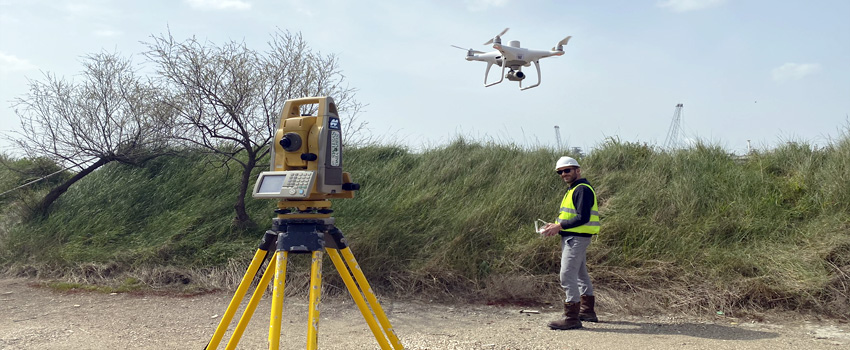
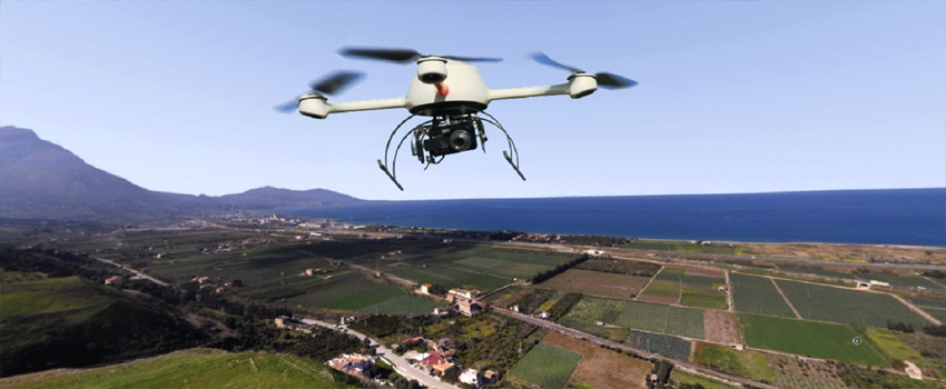
Topographic and/or photogrammetric surveys, performed using drones, enable: land mapping and three-dimensional photogrammetric cartography through the creation of mathematical models of the terrain. Various types of sensors can be installed on these drones — radio-controlled from the ground — such as very high resolution cameras to obtain high quality photographs and superb image detail which translate into high precision surveys. The use of professional drones outfit with excellent equipment, the proven ability and experience of the pilots, the scrupulous observance of procedures and attention to flight plan organization specific for areas under investigation, the adequate ground support for determination of the three spatial coordinates for a sufficient number of targets visible in the images and thus useful for the geo-referencing model: all these aspects play a role in the final result and are always performed in full safety, an indispensable condition for the success of a safe, meticulous and detailed survey.
Our technical office can provide the expertise necessary to process the material produced by the on-site survey campaigns and consequently reprocess the photogrammetric material, produce DEMs and orthophotos and follow you throughout all stages of the photogrammetric survey.
Our technical office can provide the expertise necessary to process the material produced by the on-site survey campaigns and consequently reprocess the photogrammetric material, produce DEMs and orthophotos and follow you throughout all stages of the photogrammetric survey.
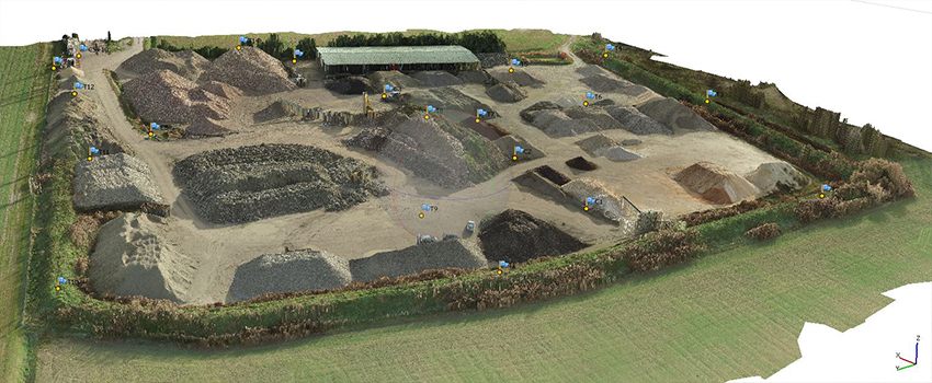
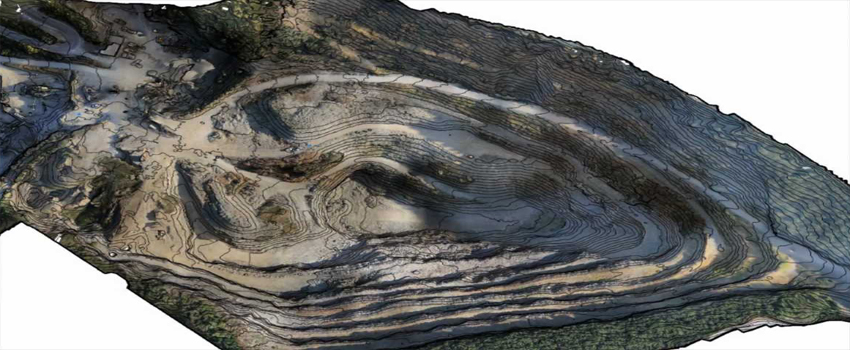
The following outputs are produced:
- orthophotos, rectified and geo-referenced in scale to perform metric calculations
- 3D models of the mapped area for volumetric calculations, monitoring and structure surveys
- DEMs and elevations that can be used on Google Earth for real navigation on the ground
- photogrammetric materials for prime quality views of the structures involved in the photogrammetric survey
- Topographic surveys and mapping of agricultural lands, excavations and landslide-prone areas with area photogrammetry for volumetric calculations, altitude surveying
- Topographic surveys and building mapping with photogrammetry to obtain CAD building models and layouts, perform metric calculations, detect structural failures and more
- High resolution topography — with geographical mapping of points of interest during topographic surveys — to map the territory, detect illegal structures or control the extension and morphology of a given territory
- Topographic surveys and thermal mapping to detect illegal landfills or thermal surveys of the territory
- Spectrophotogrammetric surveys, performed using instruments that have been modified and adapted for the purpose by Drone-Servizi. Thanks to this technique, it is possible to survey plantation conditions, irrigation efficiency and search for crop diseases (infrared frequency surveys)
- Increased productivity (especially for large areas and medium-to-small scales)
- Speed
- Inexpensiveness (thanks to its high productivity)
- Uniform precision