


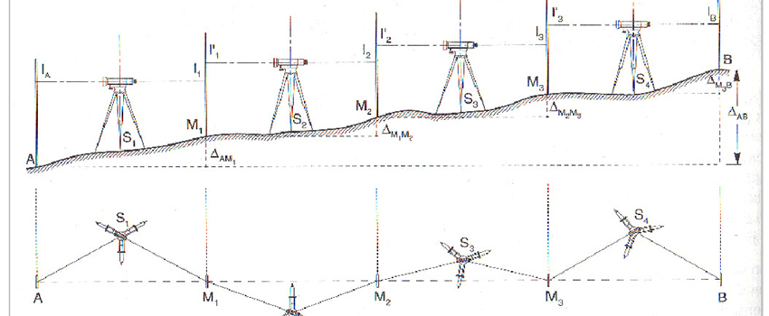
Geometric levelling is a set of operating procedures to measure the difference in level between two points, i.e. the difference in height between two points on the earth's surface.
Geometric levelling differs from trigonometric levelling in that taking of the measurements is independent of distance. Geometric levelling is performed using a level. To determine the absolute elevation of a point for which only the difference between its level and that of another point is known, it needs to be linked to a levelling benchmark, i.e. a point whose absolute position in reference to the geoid is known.