


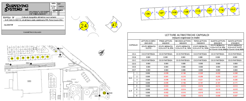
Topographic monitoring is based on the study, analysis and measurement in time of angular and spatial variations of the characteristic points investigated.
Measurement and the subsequent graphic and digital rendering of geometric and spatial characteristics of objects, structures and infrastructures constitutes a unique application of precision topography
In order to optimize on-site measurements, “monitoring networks” are implemented to minimise all external factors that could affect measurement adequacy and reliability.
Topographic monitoring is therefore widely used in the civil, industrial and mechanical engineering sectors to control the stability of particularly sensitive structures during construction, post-execution and settlement phases.
Structures monitored:
- Tunnels
- Historic buildings and monuments
- Bulkheads/Sluice gates
- Bearing walls
- Landslides
- Beams/Bridges
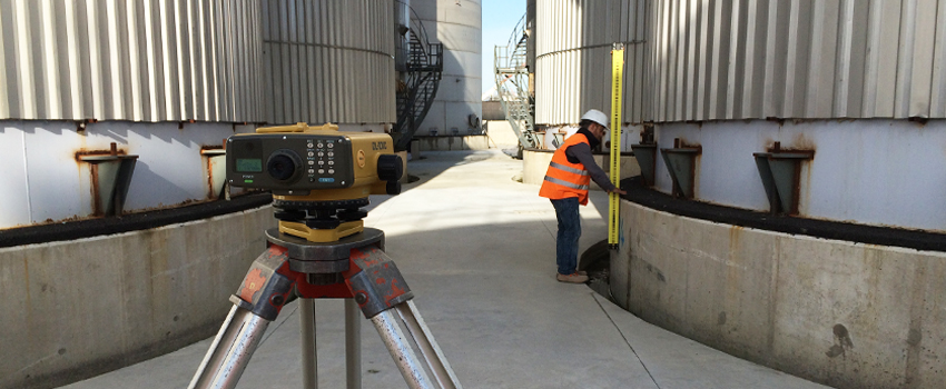
- Tanks
- Offshore structures
The main services offered are:
- High precision levelling
- Planimetric and altimetric monitoring with total station and high precision level staff
- Planimetric and altimetric monitoring via GPS
- Laser scanner monitoring
- Photogrammetric monitoring with drones
- Convergence measurement
- Processing, comparison and presentation of measurements
- Installation of continuous, automated monitoring systems