


Outdoor topographic surveys do not present any problems — e.g. the need to create a stable system of coordinates due to the lack of satellite radio signals — which make the use of the GPS (Global Positioning System) impracticable for fixing starting points of a polygonal or which make obtaining certain azimuthal angle measurements impossible.
This problem occurs when moving beneath the earth's surface, where the GPS satellite signal cannot reach the set starting station, or where compasses cannot operate easily.
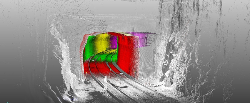
In the tunnel and during excavation thereof, it is extremely important to follow the right direction, something that is quite difficult because of the lack of reference points. Therefore, to be certain that digging is correct, topographic methods are used to ensure that the works progress in a straight line and follow the pre-established trajectory so the pre-established point is reached with a high degree of precision, sometimes with an error within just a few millimetres.
The right means for taking these measurements was sought in order to ensure utmost precision and reduce the error ellipse (spatial uncertainty of a given point).
Physics has found the solution in a simple law — the principle of conservation of angular momentum — the fundamental law governing the function of gyroscopes, which resist the forces acting on the axis of rotation and thus always remain oriented on the original direction.
Such instruments then eliminate the effect of the earth's rotation which means that, like a compass, even when underground they point in a pre-set direction, which may even be due north, and then measure an azimuth.
Once set, this instrument is placed under the theodolite to orient it and then measurements can proceed.