


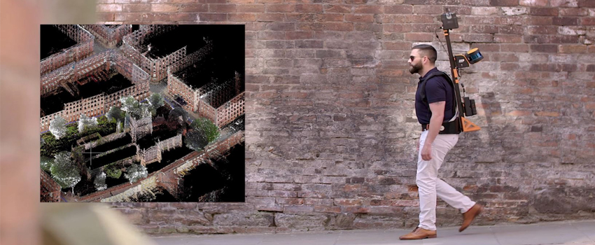
More and more there is the need to switch from a Terrestrial Laser Scanner to a Laser Scanner on the move.
On the other hand, a need dictated by the market: more and more speed is required in the acquisition of laser data and more and more productivity. Surveying in motion is certainly not new, but the real limit in using this technology is linked to the presence of the GPS signal, in addition to the high costs of these systems.
The epochal transition in the use of the Laser Scanner in motion in the absence of GPS signal is now possible thanks to SLAM technology.
It is a technique where the instrument that moves in an unknown environment builds the map of that environment in "real time" , SLAM stands for Simultaneous Localization And Mapping.
The main uniquenesses :
- Modularity of Laser systems
- Laser Scanner able to work with any inclination
- It works even in the absence of light
- Possibility of detecting control points
- Laser data re - processing function
Fields of application :
- Residential construction
- Industrial construction
- Infrastructure
- Archeology and excavations
- Roads and street furniture
- Forestry and dendrological survey
- Terrestrial, work accounting, etc.
- Calculation of inert material volumes, fiscal warehouses, etc.
- Integration with other relevant systems.